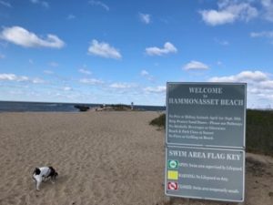
Last week Teah and I brought you to Willards and Cedar Island Trails in the Meigs Point section of Hammonasset State Park in Madison, CT. In part two of this series, we’ll take you to the Moraine Trail, “Shell” Beach, and the trail behind it, also in Meigs Point!
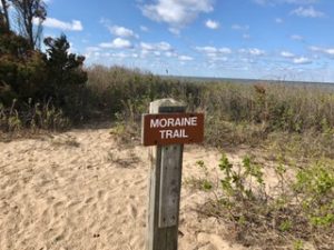
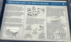
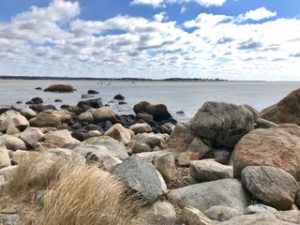
Along the foot of the Moraine Interpretive Trail, you’ll find boulders left by glaciers from millions of years ago. Moraine means exactly that- material left behind by a moving glacier. The topography in this area is made much more interesting by these incredible rock outcroppings.
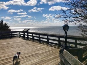
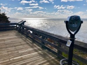
The view from the platform at the top of the Moraine Trail is magnificent at any time of year!
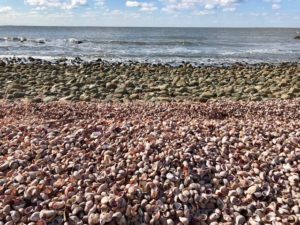
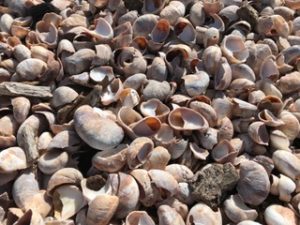
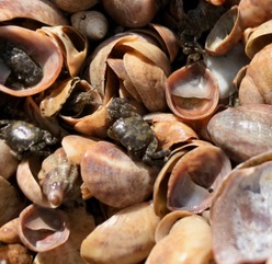
The Moraine trail leads to what I call “Shell Beach”, given its name due to the immense amount of Common Slipper Shells that cover the beach. Other shells can be found, such as the Atlantic Oyster Drill, Mussels, Oysters, among others, but Slipper Shells dominate the area.
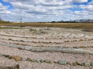
Looking opposite the beach toward the marsh, you’ll see the platform at the end of Cedar Island Trail, and Meigs Point Nature Center. Amazing birds congregate in this area in the warmer months (including Osprey in a platform nest). Humans created this really cool Labyrinth Walk on the beach facing the marsh.
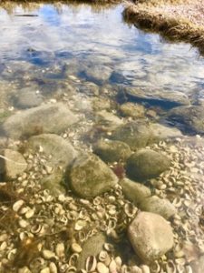
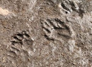
Crabs can be found down by the water, especially in times of mid to low tides. Just turn rocks over and you’ll see them scurrying about. On this day I found many juvenile Asian Shore Crabs, an invasive species.
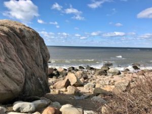
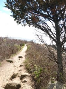
The path past the beach walking east is full of interesting vistas, tidepools, and glacial rocks.
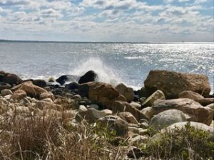
Making it to the end of the trail is its own reward! Magnificent views of the mouth of the Hammonasset River, Clinton Harbor, and Long Island Sound greet the patient hiker. Piping Plover nesting grounds are off-limits to humans. But the rocks to the right make for a wonderful place to sit and listen to the waves lapping at the shore. In cooler weather, seals often lie on the rocky outcroppings in the distance.
That brings us to the end of Part 2 of our Virtual Field Trip: Hammonasset Moraine Trail. Enjoy this peaceful view, and look forward to our final post- Part 3: Hammonasset State Park: Main Beach. Enjoy!
